At S'edav Va'aki Museum, visitors enjoy two outdoor walkable trails. The primary trail is called the Interpretive Platform Mound Trail. It showcases why this place is special to native people today, and why the City of Phoenix is dedicated to preserving this important archaeological site.
The second and newest trail at the museum is the Portal Loop Trail. On this trail, visitors will learn how water plays a sustaining role for all living things in the Sonoran Desert. Canals, for example, are an important example of how people, past and present, have adapted to their environment.
Interpretive Platform Mound Trail
Walk the 2/3-mile ADA accessible trail along the platform mound. Interpretive signs on the trail explain significant features including a replica adobe compound, replica pithouses, a ballcourt, and garden.
Experience Sonoran Desert plants and wildlife. Imagine a lush riparian landscape abundant with water birds, fish, mammals and nourishing trees, reeds, and cacti. The Salt River and its offspring canals made the landscape very different than what we see today.
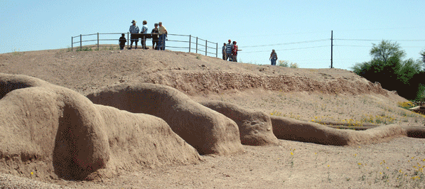
Platform Mound
The platform mound at the site of Pueblo Grande is one of the largest earthen structures built by the Ancestral Sonoran Desert People in the Salt River Valley. During the Classic Period (A.D. 1150-1450), the large platform mound was expanded on several occasions.
The O'Odham refer to this place as a va'aki (pronounced as VA-ah-kee) or ceremonial house. The structure that stands at the museum today, at its peak was the size of a football field and about three stories tall.
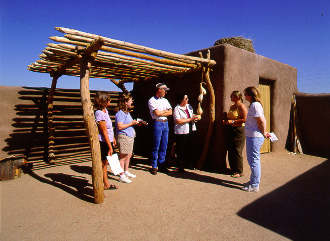
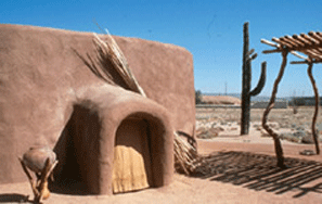
Replica Adobe Compound
Each adobe compound contained one large room.
Often, several rooms were built side-by-side and arranged within compounds. A
thick adobe wall enclosed an area in which one or more rooms were built. The
rooms within an adobe compound were places where people slept and kept their
possessions. Small hearths, located in the floor, were used for heat and light
while cooking was likely done in outside hearths or roasting pits.
Replica Pithouses
Archaeologists observed that pithouses were
regularly arranged in groups around an open central courtyard, called a
pithouse cluster. The doorways of each pithouse tended to face inwards toward
the courtyard. People likely engaged in most activities outdoors. Other
structures were present in and around pithouse clusters. Ramadas or shade
structures gave protection from the sun during the day when people were active
outdoors.
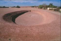
BallcourtBallcourts may have been the center of village life between A.D. 750 and 1200. They were oval, bowl-shaped depressions in the ground, surrounded by earthen embankments or mounds of dirt. Archaeologists do not know what the ballgame looked like, nor that it was even a game. There is evidence ballcourts were associated with markets or trade relationships.
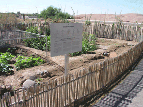
Native Crops Demonstration Garden
Over a thousand years ago the Salt River ran year-round, and Ancestral Sonoran Desert People constructed thousands of miles of canals to bring river water to irrigate their fields. Farmers grew corn, several types of beans, and squash (the three sisters). Crops were also grown for non-edible purposes. Cotton was a prized trade item and used to produce fiber that could be woven on a loom to create cloth.
Did Ancestral Sonoran Desert People subsist only on plants that they grew? No, they also gathered fruits and seeds from Sonoran Desert plants such as agave hearts, prickly pear pads, cholla cactus buds, mesquite tree pods, and saguaro fruits.
Portal Loop Trail
To guide your visit along this trail, we offer information that focuses on water, the environment, and Sonoran Desert wildlife.
 Prehistoric Canals
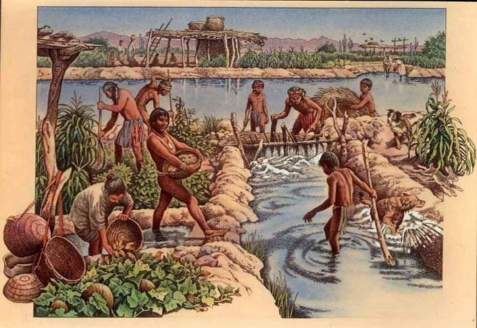
Using their hands along with wooden and stone tools, Ancestral Sonoran Desert People built and maintained the largest prehistoric canal system in the New World. Canals were used to bring water to the villages and to irrigate thousands of acres of agricultural fields.
The location of the Pueblo Grande site, on the north side of the Salt River, was ideal for constructing canals. The bedrock outcropping between Papago Buttes and Hayden Butte directed the water flow up making it easier to build canals in this area. One of the most important aspects of canal construction is determining the gradient or slope of the canal channel. If the canal is built too steeply, the water will run too fast and erode the banks. If the slope of the canal is too gentle, then silt will build up and slow the flow of water.
 Historic Canals
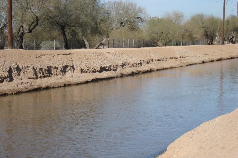
The Grand Canal, located within the boundaries of the Pueblo Grande site and next to the museum, was constructed in 1878 by Euro-American settlers. This canal is believed to have been positioned along the same pathway as canals constructed by the Ancestral Sonoran Desert People prior to A.D. 1450.
From prehistoric times until present day, canal erosion and maintenance have been an issue. For example, in 2019, the segment of the Grand Canal running next to S'edav Va'aki Museum was lined with shotcrete (concrete applied to a surface using a high-pressured hose) to help reduce erosion of the canal banks.
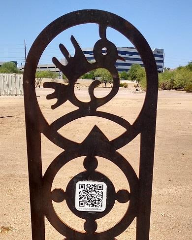
Site Neighbors
Along the trail, visitors will encounter three markers. Each marker contains a stylized image of a Sonoran Desert animal and a QR code that leads to an O'Odham song about that animal. The animals are an eagle, quail, and coyote. Listen to the songs sung by Gila River Indian Community Tribal Elder Barnaby Lewis.
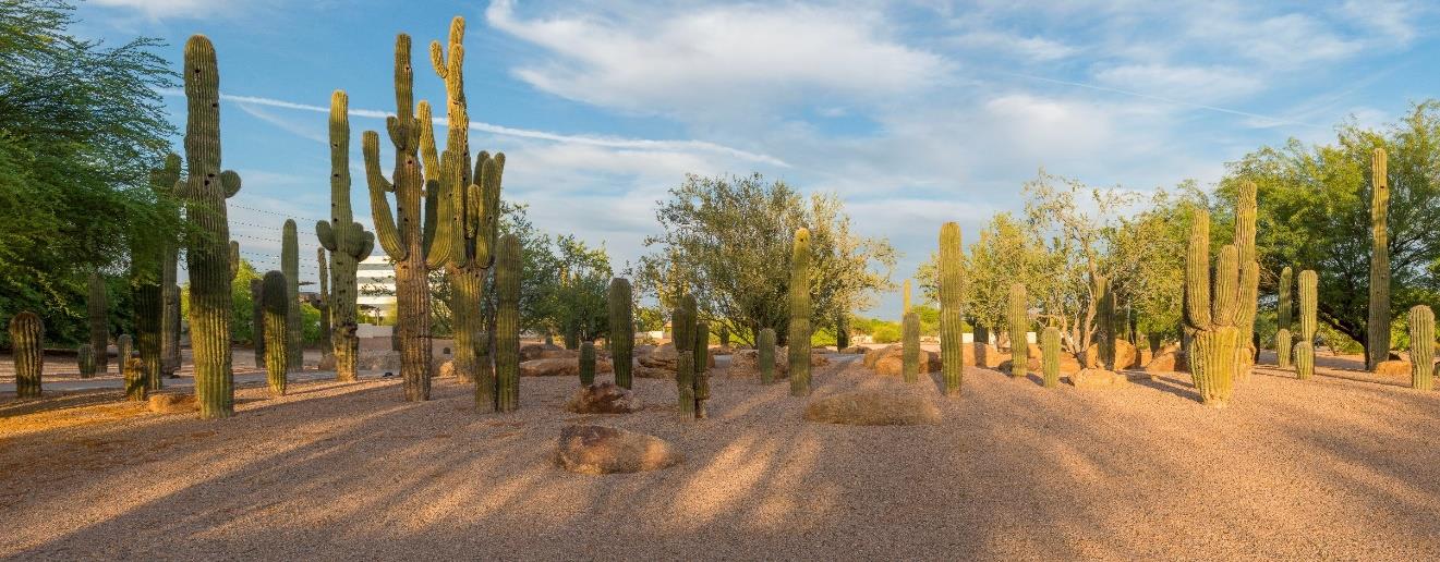
Saguaro Circle
The saguaro (pronounced Sa - WAH – ro) cactus is an indicator plant for the Sonoran Desert. If you see a saguaro, you are most likely in the Sonoran Desert. The cacti that you see at saguaro circle were transplanted to create a tranquil resting spot. These towering cacti are home to many animals such as the Gila woodpecker, purple martins, finches, and sparrows.