Phoenix launches a Citywide food drive to assist residents experiencing food insecurity during the holidays.
Van Buren Corridor Neighborhoods

The goal of each T2050 Mobility Study is to improve safety, connectivity, and accessibility for all people -- regardless of their age or ability level -- who walk, ride a bicycle, or use transit to get to their important destinations.
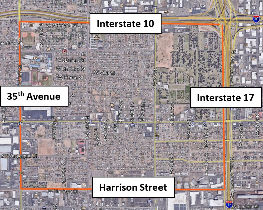
Mobility Area Description
Bounded on the north and east sides by Interstate 10 and Interstate 17, respectively, this Mobility Area primarily is made up of single-family residential homes. The west boundary is 35th Avenue and the south boundary is Harrison Street, with the southwest and southeast corners of the area including or abutting major industrial areas, as well as a large Union Pacific rail road yard. Greenwood/Memory Lawn Mortuary occupies a large portion in the northeast corner. Van Buren, Adams, and Jefferson streets provide important east-west connections into downtown Phoenix. Several bus lines serve the area, including routes 3 (Van Buren), 27 (27th Avenue), 35 (35th Avenue), and express routes 562, 563, 571, and 573.
The Mobility Area is defined by the strong presence of Van Buren Street, which bisects area and is a focal point for many community and commercial services. The Van Buren Corridor Neighborhoods maintains a strong Hispanic and Latino community and is historically home to a collection of mature single-family residential neighborhoods like Willow Square, North Willow, Westmanor Homes, and Hyde Park. The area has also incrementally developed as an employment hub of industrial and commercial uses – including warehousing, transportation, logistics, shipping and other businesses. The study area also will feature prominently by the Capitol/I-10 West Light Rail extension, which will bring opportunities for further development, redevelopment and investment to the diverse communities.
Supporting these neighborhoods are three existing schools including Carl Hayden High School, J.B. Sutton Elementary School, and William R. Sullivan Elementary School. In addition, the Chicanos Por La Causa (CPLC) Community Center is located near the center of the study area at Van Buren Street just east of 32nd Avenue. The CPLC Community Center and is one of the most significant destinations within the MA 13 study area and is a staple of the community. The Sinaloa Plaza and Westdale Shopping Center on Van Buren Street provide retail shopping, restaurant, and grocery outlets for the immediate area. This area also includes three City parks. The two larger parks, Falcon Park and Willow Park, are located north of Van Buren Street, while the one smaller park, Yunya Park, is located south of Van Buren Street.
Mobility Area Location Map
Project Manager Contact Information
Brian Fellows, Principal Planner