Active until Friday, July 10 at 8 p.m. For public safety, certain trails are restricted from 8 a.m. to 5 p.m.
Midtown Core Transportation Study
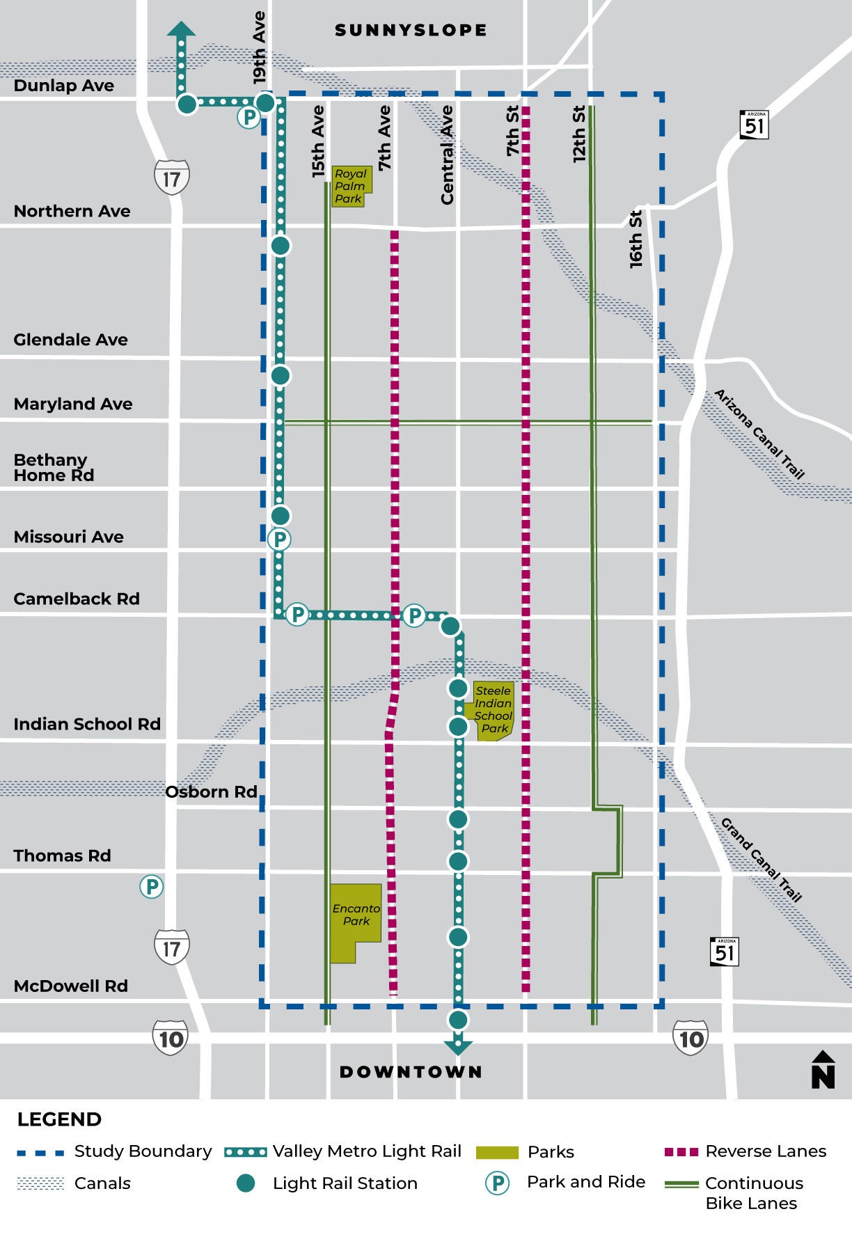
The Midtown Core Transportation Study uses recent traffic analysis, new growth projections and your insights to keep Midtown moving.
West study boundary: 19th Avenue
East study boundary: 16th Street
South study boundary: McDowell Road
North study boundary: Dunlap Avenue
The City of Phoenix Street Transportation Department is studying how transportation should evolve in Midtown Phoenix as the area continues to develop. The study will use recent traffic analysis, new growth projections, and public insights to explore ways to enhance safety, improve mobility and strengthen connectivity for everyone traveling in and around Midtown.
Study Goals
The findings from this study will:
- Evaluate the capacity and connectivity of existing and planned transportation networks.
- Compare the capacity and connectivity to projected travel demand.
- Prioritize existing projects and planned transportation projects.
- Identify gaps in the area’s future transportation network.
- Suggest additional strategies or projects necessary to fill gaps in the area’s future transportation network.
- Evaluate the 7th Avenue and 7th Street reversible lanes to determine their long-term role within the transportation network.
Public Input Opportunity
A virtual public meeting was held on Thursday, May 7, at 6:00 p.m. Due to a worldwide Webex outage, the meeting recording is currently unavailable. Please refer to the presentation slides at the top of this webpage.
Everyone is invited to share insights using the study feedback form and interactive map activity that will be open through Friday, May 29. (see link above)
Study Milestones
