From Thursday, March 19 through Sunday, March 22. For public safety, certain hiking trails are restricted from 8 a.m. to 5 p.m.
South Downtown Neighborhoods
The goal of each T2050 Mobility Study is to improve safety, connectivity, and accessibility for all people -- regardless of their age or ability level -- who walk, ride a bicycle, or use transit to get to their important destinations.
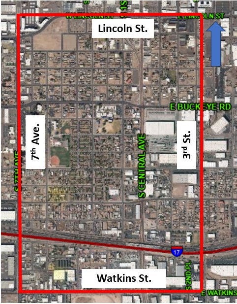
Mobility Area Description
The South Downtown Neighborhoods Mobility Area is immediately south of growing downtown Phoenix, and is adjacent to the old warehouse district, which is being redeveloped, including multi-story housing. Central Avenue, Phoenix’s primary downtown north-south spine for offices and businesses, bisects the area, with much commercial, light industrial, and trucking businesses remaining. The first downtown grocery store in 50 years will open in 2019 at 1st Street & Jefferson Street, and likely will become another important destination. The South Central Phoenix extension to the Valley Metro Light Rail system will provide connections between downtown and South Phoenix via Central Avenue, and likely will be a catalyst for significant growth along this corridor. Lowell Elementary School and Academia del Pueblo Elementary School are located here. There are three small parks and one community swimming pool in the area, and an additional park immediately to the west. Phoenix Memorial Hospital and Abrazo Health Care are important destinations.
Mobility Area Location Map
Update / Next Steps
A list of proposed recommendations to improve pedestrian and bicycle mobility in the South Downtown Neighborhoods were identified by the study team based on an analysis of the study area and public input. This list is included in the Proposed Conditions Report below.
Project Manager Contact Information
Brian Fellows, Principal Planner